A Drone Mapping Company Built for Real-World Results
Precision Drone Ops is a professional drone mapping company in Australia, delivering accurate, fast and actionable aerial data across agriculture, mining, construction and environmental sectors.
From agriculture and infrastructure to environmental monitoring, commercial and insurance companies, our mission is simple: deliver reliable drone services that help you make better decisions, save time and work with confidence.
Bringing Experience and Aerial Precision
Precision Drone Ops was founded with one goal in mind — to solve a problem we knew first hand: traditional methods were too slow, expensive or vague for today’s fast-paced industry needs.
We built a drone mapping service that’s easy to book, flexible for remote work and accurate enough for technical teams. From farms to mine sites, we’ve created a solution that gives clients what they need, which is real data, fast turnarounds and to the point.

Professionally captured and processed data, verified in-house for accuracy you can rely on.
We handle all mapping, imaging, and data processing ourselves — ensuring accuracy, speed, and full quality control.
Our setup is built for rural and off-grid jobs, with mobile power and rugged equipment ready to go anywhere.
All flights are conducted by licensed and insured drone pilots, fully compliant with CASA Part 101 regulations.
Helping optimise crop health, yield potential, and resource management through multispectral imaging, NDVI analysis and precision field mapping.
Providing orthomosaics, site models and progress tracking data to support planning, project management and compliance reporting.
Supplying aerial insights for asset management, environmental monitoring, urban planning and regional infrastructure assessments.
Enabling non-invasive habitat mapping, species monitoring, erosion tracking and environmental impact reporting through high-resolution and thermal imaging.
Delivering detailed inspections and geo-referenced records for insurance companies and third parties, utilities, industrial facilities, roads, railways and remote infrastructure assets.
Whether it’s a broadacre scan or a custom one-off job, we design every mission with your data goals in mind.
Drone Services for Agriculture, Infrastructure & Industry
We provide scalable, professional drone solutions tailored to projects across regional and metropolitan Australia:
Multispectral Crop Health Scanning
NDVI maps, crop stress detection, contour data, variable rate planning, and spray maps
Drone Mapping & 3D Modelling
Orthomosaics, elevation models, photogrammetry, and terrain analysis
Infrastructure & Asset Inspections
Irrigation systems, pipelines, powerlines, fencing, tanks, towers
Insurance Asset Monitoring
buildings, infrastructure and asset monitoring
Construction & Earthworks Monitoring
Site progress tracking, stockpile volumes, cut-and-fill maps
Wildlife & Environmental Surveys
Habitat change, vegetation coverage, erosion tracking
Custom Data Solutions
Secure, in-house data processing and optional long-term image storage
No two jobs are the same, and that’s exactly how we operate. Instead of using a one-size-fits-all approach, we adapt every flight to your unique goals and requirements.
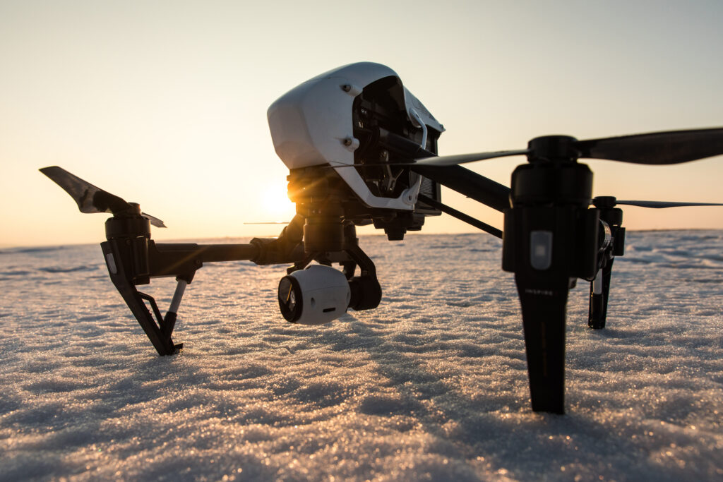
We use a range of professional-grade drones and advanced imaging sensors to deliver fast, reliable results across industries. Our platforms are equipped for high-resolution photography, multispectral crop health scanning, detailed 3D modelling, and precision inspections — giving you actionable, geo-referenced data for every project.
Whether it’s capturing cinematic footage for marketing, scanning vegetation indices for agriculture or conducting high-accuracy asset inspections, we deploy the right aerial technology for the task at hand.
Every scan we deliver is fully geo-tagged, processed internally, and secured — ensuring maximum accuracy, data protection and complete control from flight to final file.
Speed & Accuracy – We deliver fast results with centimetre-level precision
In-House Data Processing – All data is handled securely and efficiently — never outsourced
Minimum Booking Guarantee – Ensures every project is viable and cost-effective
Scalable Operations – From small paddocks to 8,000+ hectare farms and industrial sites
Priority Callouts – Need urgent scanning? We offer 7-day express turnaround
Transparent Pricing – Honest, tailored pricing based on your project’s scale
In short, we deliver reliable insights that help you plan smarter, act faster and make informed decisions across farming, construction and asset management.
Clients choose Precision Drone Ops because we combine cutting-edge UAV technology with practical industry knowledge. Every project is handled by a licensed pilot, with data verified and delivered by experts who understand your operational needs.
We don’t just fly drones — we deliver actionable insight. That’s what makes us a trusted drone mapping company across NSW and beyond.
With operational bases in Coonamble and Gosford, we serve clients Australia wide, offering flexible drone solutions wherever they’re needed.
© 2025 Precision Drone Ops PTY LTD | ACN: 685 754 726 | CASA Certified | All Rights Reserved
We’ve received your message and a member of our team will get back to you within 24 hours.
For urgent enquiries, feel free to call us directly at
Stefan : 0434129714
Brendan : 0408800449
We look forward to assisting you!
We’ve received your request and our team will be in touch within 24 hours to confirm all the details.
If your enquiry is urgent, please call:
Stefan : 0434129714
Brendan : 0408800449
Thank you for choosing Precision Drone Ops — we look forward to working with you!