Aerial Insights Witout Environmental Impact
Drone technology has changed the way we monitor wildlife. Providing faster, safer and more accurate data wile minimising ground disturbance and human impact. Enquire today how Precision Drone Ops can help you with all your Wildlife drone monitoring.
🔎Wildlife Drone Monitoring
At Precision Drone Ops, we provide non-invasive wildlife monitoring services using advanced drone technology. From tracking animal movements to documenting habitat change, our aerial systems deliver accurate, up-to-date data for conservationists, researchers, and local councils across Australia.
Because we capture imagery from above, there’s no need to disturb the environment making it ideal for ecologically sensitive zones and remote areas.
⚙️ Wildlife Drone Monitoring That We Offer
Aerial Data for Conservation, Research, and Land Management
Our wildlife drone services support a wide range of ecological applications:
Fauna Movement Tracking
Monitor the location, patterns, and behavior of native species without disturbing natural activity.Habitat Mapping
Track changes in vegetation cover, water availability, and environmental stress factors over time.Erosion & Land Condition Surveys
Use drone-generated elevation and contour maps to assess erosion, water flow, and land degradation.Environmental Monitoring for Councils & NGOs
Provide timestamped data to meet compliance, support grant applications, or guide policy decisions.Thermal Drone Support (optional)
Identify nocturnal species or spot hidden animals using thermal imaging (available on request).
Benefits of Wildlife Drone Monitoring
Non-Invasive and Low-Impact
Monitor sensitive areas without needing foot traffic, helicopters, or vehicles.Scalable & Repeatable Surveys
Conduct regular, large-scale scans with consistent data across time.High-Resolution Visuals & Video
Get ultra-clear aerial imagery and 4K video — ideal for documentation and media.Fast Turnaround & In-House Processing
All footage is securely processed by our team, with full control over editing and export.Digital Records for Policy & Conservation Support
Build permanent visual records to track change over months, seasons, or years.
🦘 Use Cases for Wildlife Drone Monitoring
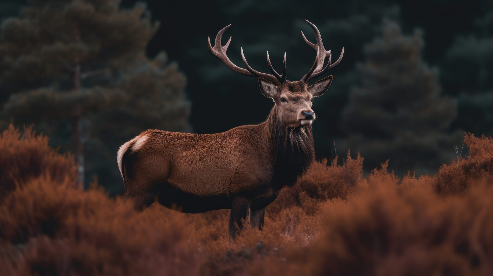
Feral Animal Surveillance & Population Control
Track invasive species such as wild pigs, foxes, and deer in agricultural or remote areas. Aerial monitoring supports targeted control programs, helps reduce crop damage, and provides visual evidence of animal patterns and population hotspots.
Pre-Development Environmental Assessments
Conduct fast, non-invasive fauna surveys before clearing land for infrastructure, mining, or construction projects. Drone imagery supports environmental compliance, biodiversity management, and permit reporting.
Threatened Species Monitoring & Observation
Use drone platforms to safely monitor endangered or protected wildlife — such as koalas, gliders, or raptors — without entering or disturbing sensitive habitats. Ideal for conservation groups, consultants, and park authorities.
Wildlife Population Surveys & Counting
Carry out accurate animal population counts from the air, including koalas in tree canopies, kangaroos in open scrub, or bird colonies across wetlands. Aerial scanning with zoom or thermal payloads provides scalable data across large or difficult terrain.
Post-Event Habitat Impact Assessments
Evaluate wildlife activity and recovery after fire, flood, or land disturbance. Drones allow for fast, low-impact assessments over large areas to support funding applications, restoration planning, or habitat monitoring.
Crop & Livestock Conflict Monitoring
Monitor wildlife activity near crops, fencing, or water sources to help farmers mitigate crop loss, damage to infrastructure, or livestock stress from interactions with native or feral animals.
Seasonal Wildlife Mapping for Councils & Landcare
Support land care and council initiatives with aerial data on animal movement, habitat use, or pest presence. Output formats are tailored for internal reporting, GIS mapping, or grant documentation.
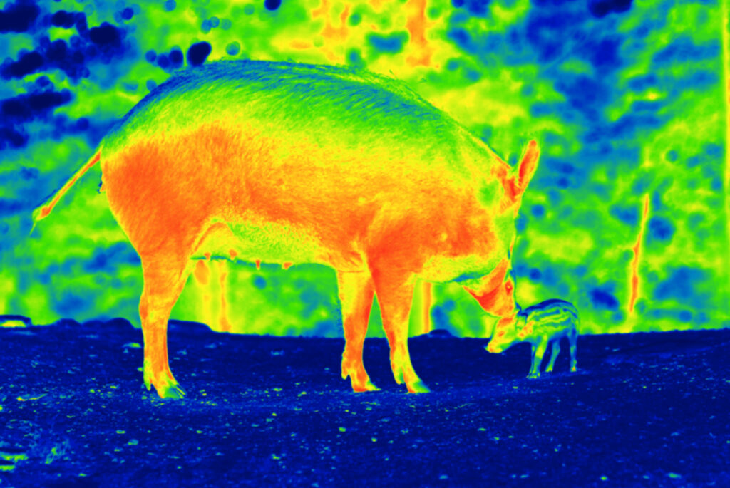
🔥 Why Thermal Imaging & Night Operations Work So Well
Wildlife Activity is Often Highest at Night
Thermal cameras can detect animal heat signatures regardless of lighting — making it possible to monitor movement patterns and populations without visible light or disturbance.Cover More Ground Than Traditional Spotlighting
Instead of using vehicle-mounted spotlights or field teams, drones with thermal payloads can scan entire paddocks or bush corridors quickly, quietly, and from above.Accurate Data Without Contact
Thermal imaging provides precise tracking of animals in heavy scrub, tall crops, or difficult terrain — without entering the environment, damaging ground cover, or spooking the species being observed.